Now that drones are e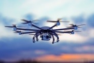 njoying a meteoric rise in popularity it was only a matter of time before someone raised the question of how to integrate drone technology with GIS. Really, they are perfect for each other; GIS allows for the visualisation, questioning, analysing and interpretation of data both on the ground and in the air. So drones really are no stranger to those already in the GIS industry.
Photogrammetry and Drone Technology
Photogrammetry is the science of making measurements from photographs. Historically, and up until very recently, these photographs were taken from satellites or manned aircraft. The end result can be #D models, drawings, maps or measurements that is then analysed to extract various data. The accuracy of the image is crucial to those working in several fields, including engineering, quality control and geology.
The images produced by drones can not only cost far less to produce than their traditional counterparts, but they are also of a higher resolution and photos can be taken more often.
Why GIS Professionals Need Drones
Not only are drones incredibly useful to those working in the GIS industry, but they also hold much market value. There is a race in progress; one that will hopefully see front-end software that can be useful in the daily work of surveyors and mapping professionals as they plan missions, manage their work, capture aerial images and create their models.
Indeed, some software is already being produced that is slashing the time it takes for drone images to be processed into maps, while other software is combining scientific measurements with satellite imagery and placing it online for scientists, researchers and the like to learn from.
Modifying Existing Technology
Much existing imaging technology is being modified in order to be used with drones. For example, LIDAR technology is incredibly useful for professionals wanting to capture the smallest details not able to be captured by photos. Based on the concept of RADAR, LIDAR uses laser light as opposed to radio waves. LIDAR projects laser beams in multiple directions to collect data. The unit then processes that data, which can be sent to a scanner to produce a real-time and virtual map.
However, LIDAR units are far too heavy to be mounted on drones, as they were historically manufactured for mounting on manned aircraft or trucks. Today, however, these units are being manufactured to be smaller and weigh less, making it possible for them to be mounted on drones.
What’s to Come?
As drone technology continues to evolve, there is no doubt that it will be an integral part of the future for many industries like mapping, architecture, construction and engineering. The increasing number of drones will likely result in the construction of highways were multitudes of them can travel and create aviation maps to assist pilots with knowing where and where not to fly. In fact, it is a project that is already in progress.
Another likely occurrence will be regulation concerning the usage of drones and where they can and cannot be flown. Safety is the primary concern here, with many items needing to be taken into consideration. For example, many models of drone may not allow for safe navigation through particular areas. As well, the guidance technology used by drones can be vulnerable to disruption and interference by hackers, the intentional jamming of signals, and by solar activity.
Privacy remains yet another concern, as well as the infringement on the rights of others to enjoy their properties. However, it is highly doubtful that the noise and potential privacy threat of drones will spell their demise.