Key things to consider when creating optimised routes for winter maintenance contracts
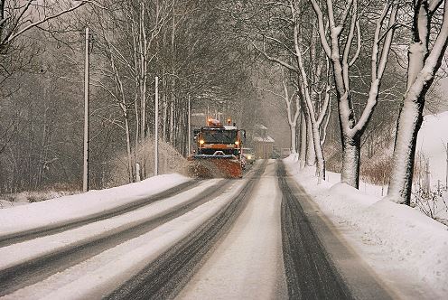
Winter maintenance is a key responsibility of local authorities and private contractors between the months of October to March. Maintaining an efficient gritting and ploughing service is crucial to keep the public moving and most importantly safe on the roads, and to avoid accident claims due to the streets being inadequately serviced. Periodically reviewing the service coverage and updating & optimising current routes can save councils a fortune.
RouteSmart for ArcGIS is a fantastic modelling tool to compare vehicle numbers based on varying criteria, such as climatic domains, treatment time, spread rate and available facilities, inevitably to reduce vehicles and mileage.
Many councils can benefit from a ‘domain’ approach. Meteorological Companies can be employed to advise on climatic domains more prone to ice and snow events. Based on the daily forecast, only the vehicles within the coldest domains need to be deployed, therefore creating financial savings.

Average road width information available in the Ordnance Survey Highways Streets data, can now be fully utilised to ensure all streets are gritted adequately, and to reduce the occurrence of over-salting and under-salting. Road widths can additionally be used to identify streets that should be passed in both directions, or streets that may require multiple passes. Reducing under-salting can significantly lower the risk of potential legal action against local authorities for poorly maintained gritting coverage.
The optimised travel paths can be made available to Integrated Skills’ in-cab solution, Navigator, easing navigation for the driver. One step further would be to activate automated spreading, if spreading information (width and rate) has been utilised. The control box will trigger gritting or free-travel based on route’s GPS position within the route sequence.
Routes are held in Fusion, a central location and single source of truth which can be viewed by customer service teams in order to check public queries or disputes. Reports can be exported to display the exact time streets were gritted, and if there were any streets partially or not salted, which may correlate to issues logged by drivers during the course of the route. These reports are beneficial for comparing route performance over the winter season, in order to know where inefficiencies lie and where improvements can be made.
With ever changing criteria set for gritting prioritisation, spatial information can be viewed in ArcGIS, in order to review and guarantee all criteria is being met, e.g. access to hospitals with A&E facilities. Regular updates of the Ordnance Survey Highways Streets data, ensures that the coverage can be kept up-to-date with changes and additions to the street network.
Would you like to know more about Optimising your Winter Maintenance Routes? Fill in your details below and let us know how we can help.
© 2024 Suite 3A, Chapel Allerton House, 114 Harrogate Road, Leeds, LS7 4NY
ukinfo@integrated-skills.com | +44 (0) 3300 888 670
Website Designed & Built by we are CODA